Nepal - the Annapurna Circuit
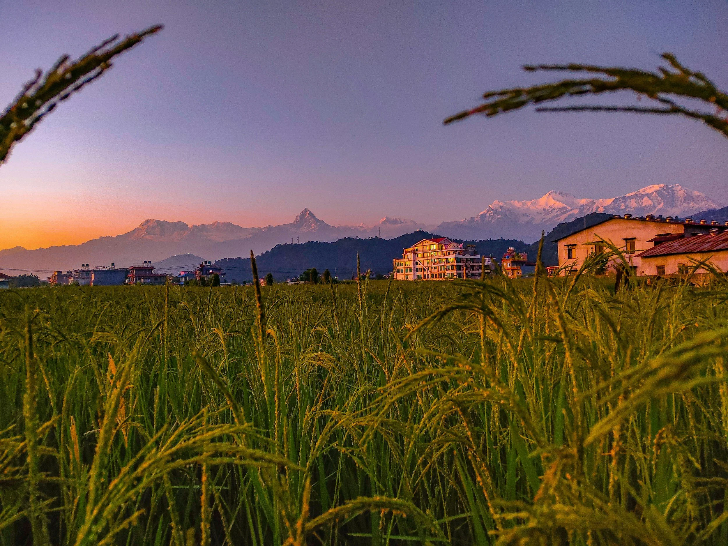
The time and place for working out this travel report is after completing the trek in Pokhara, a touristy 'lakeside' spot south of the Himalayan Annapurna mountain range. In the seventies, it was still the end station for many a hippie after an 'Asia overland tour'; now there are many hotels and tourist shops, but weed and mushrooms remain available. Normally, we would leave these places within a few hours—it's also tropically warm with a heavy downpour every afternoon. However, now it's a delightful stopover with what was sorely missed after nearly ten intensive days in the mountains: good coffee and internet. On one hand, it's nice to be completely cut off; on the other, we notice how dependent we become on a connection to the outside world—we can hardly do without the news and developments. Good coffee needs no further explanation.
Nine days in the high mountains were breathtaking but also physically exhausting. Due to the minimal preparation, a strong appeal was made to our ingenuity and adaptability. It was quiet and sometimes lonely in the mountains. The (thin) air was as pure and fresh as can be. However, the path to the top turned out to be very dangerous in some places, so we were glad to have hired a sherpa relatively quickly on the route, and what now predominates is relief and satisfaction.
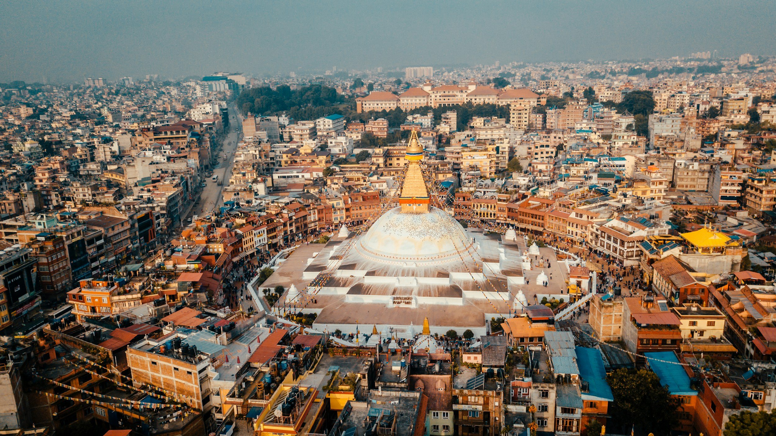
bustling capital Kathmandu
Day 1: Kathmandu – Ghermu (1,350 m – 1,200 m)
The roads and buses are of the worst kind we've encountered on travels in developing countries. We can only be glad to be out of Kathmandu, a busy, dirty, and noisy capital. Although it's the political, religious, and business center of the country, it's mainly the starting and ending point for many travelers. This extremely poor country (80% survive on less than 2 dollars a day) with 30 million inhabitants also has the only serious (international) airport here. The first impression shows similarities to India, and the damage from the massive earthquake three months ago seems manageable. However, appearances are deceiving, and in many rural areas where houses are made of clay or wood, the damage and pain are immense. Tourists are massively avoiding the country, 'adding insult to injury' because the country needs the tourist dollars so badly, especially now. Exceptions regarding obtaining 'trekking permits' and entrance tickets for national parks are not made, and right now, some sly locals are trying to squeeze tourists to the last cent, although our negotiating position regarding accommodation choices can be described as quite strong.
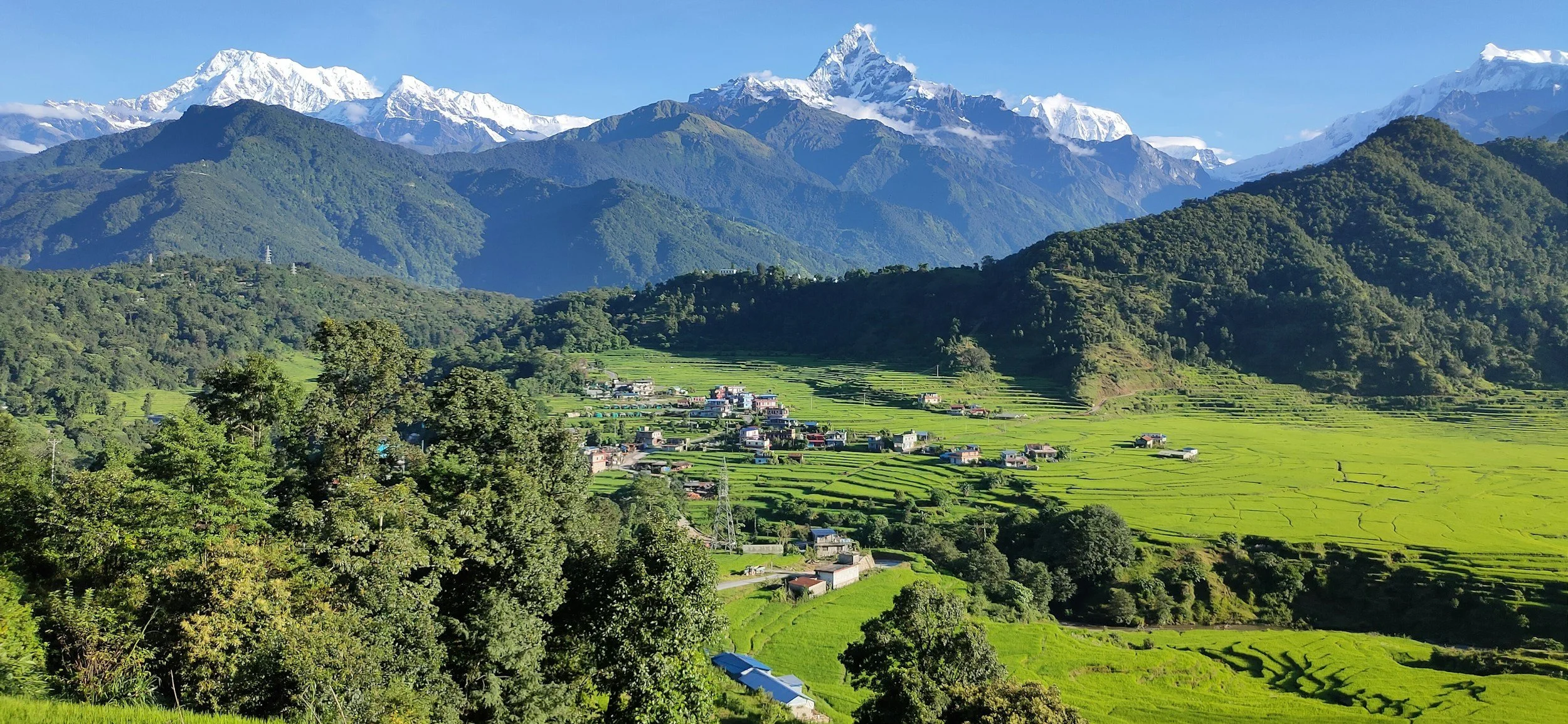
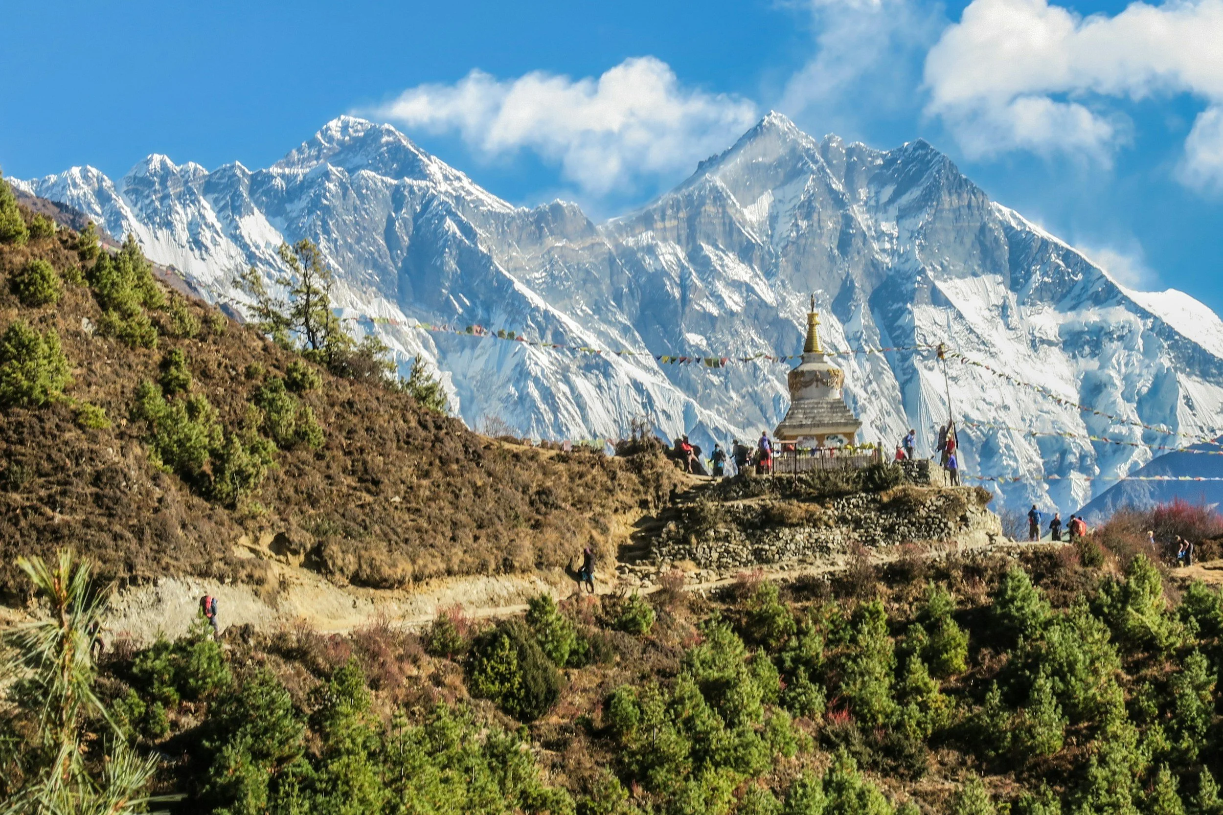
from lush green forests to rocks, snow and ice
Out of the sweltering capital, seven hours of successive, stuffy bus rides follow, during which we decide not to walk the first part of the 'Annapurna Circuit' (AC) because it's also frequented by motor vehicles. The AC is a looping trekking route around the Annapurna mountain range, forming part of the complete Himalaya. Mainly executed counterclockwise, the circuit has long been renowned as one of the most beautiful longer treks in the world. In the last decade, it has had to relinquish some of this fame in favor of facilitating motorized transport. It's a 'trade-off' for the local mountain people who have always trekked through the mountains, trading or for social purposes. The vast majority is still free of jeeps, as are the rice fields of Nagdi where we set our first steps in the afternoon at 4:00 PM. This includes a backpack that's too heavy in tropical conditions, so three hours later, we arrive exhausted and completely soaked in twilight at a 'lodge.' The farm shed barely deserves the title 'hotel,' and from the host's body language, it seems like no tourist has been there in light years. In a hurry, a bed with the thinnest kind of foam mattress is made up in a wooden shed infested with insects. The price of 1 euro matches it, and a meal can even be put together, after which we can still shower and sleep reasonably well.
Day 2: Ghermu – Daraphani (1,200 m – 1,900 m)
The first urgent advice from the authorities to never walk alone we naturally ignore right away and have to retract after just one day. It's clear that we need a porter ('sherpa' or 'porter'), if not for the (excess) baggage, then for safety. The route is littered with tricky obstacles and steep mountain walls next to narrow gravel paths where a misstep probably means the end.
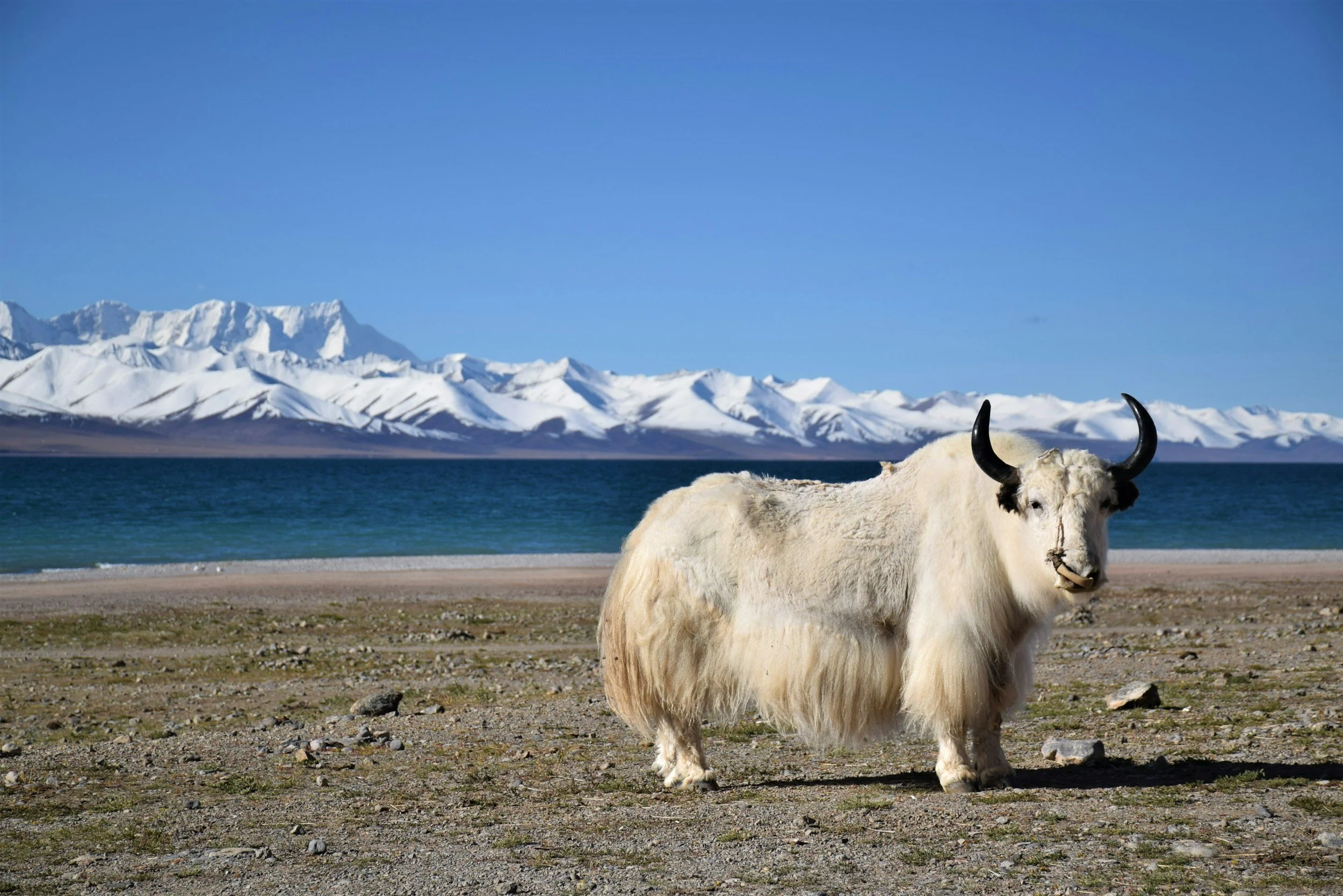
Be prepared to encounter some hairy yaks
Over a breakfast of pancakes and local honey, we negotiate with the head of the house about hiring help, and keeping the money flow within the family, he quickly puts forward his nephew who, as a teacher, has a few weeks with nothing to do anyway. This young guy gets straight to work, taking the lion's share of the baggage. He will walk everything up to the final climb on slippers (!), awe-inspiring even though locals are used to it. Mutual communication is somewhat hindered because we don't speak 'Nepali' and his English could use a refresher. However, Sherpas are an ethnic minority near the Everest area, famous for their carrying capacity and activity at high altitudes.
We climb steadily over the gravel path next to a raging river that, fed by countless tributaries, carries the (melt) water to lower areas. It's monsoon season, and we'll notice that soon enough. The monsoon arrives around noon from the Bay of Bengal over this area, and it will pour hard for now. We were prepared for this. Nevertheless, after seven hours of walking, we arrive soaked at our final destination. We are pretty exhausted, and the small aches indicate that we have to pay the toll for pushing a bit too hard the day before. It seems traditional that locals are charged nothing for food and shelter while tourists pay full price. There's a gaping gap between 'Nepali' and 'tourist' prices.
Day 3: Daraphani – Dhukurpokari (1,900 m – 3,000 m)
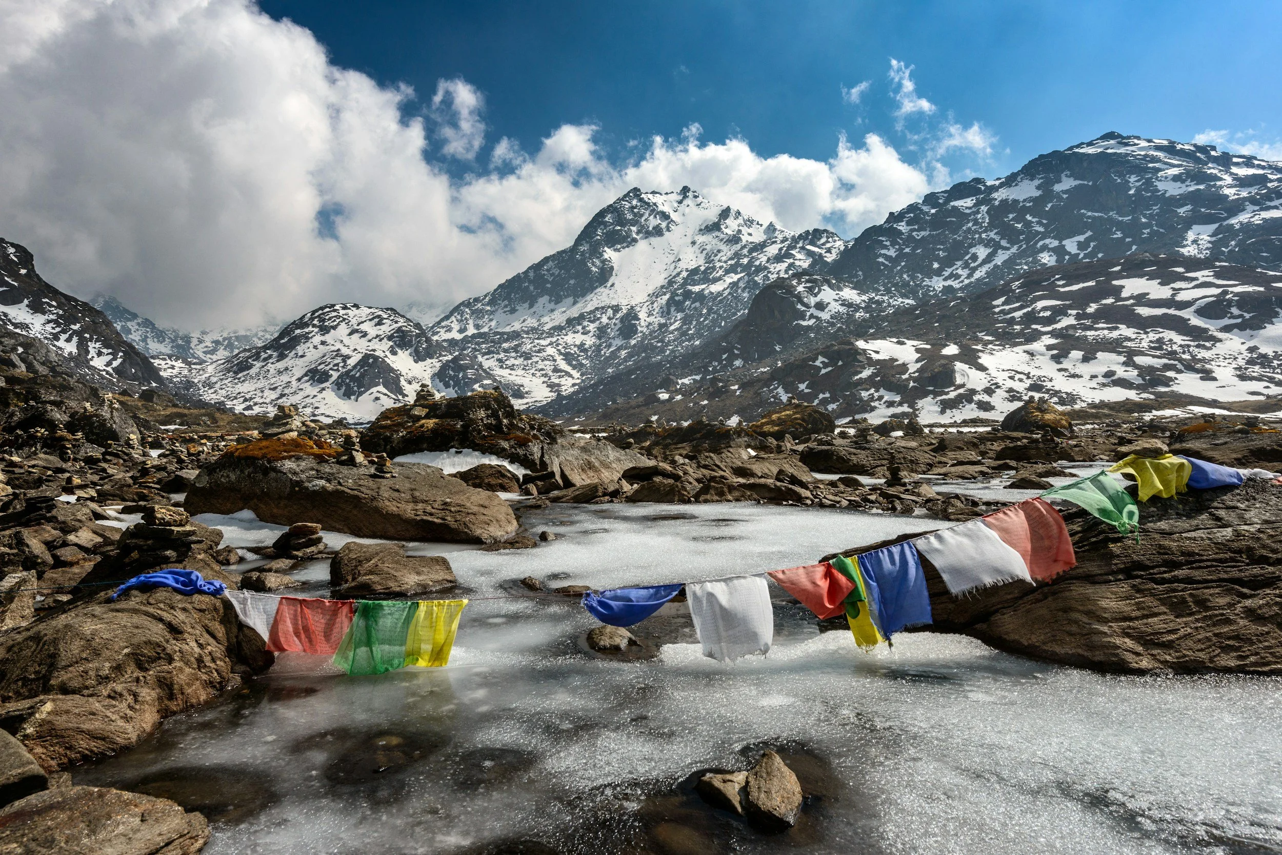
It's low season, and tourism has dropped by about 90% after the earthquake, resulting in empty trails and lodges. Admittedly nice and quiet, but little conversation. Plenty of time for brainstorming about how to better organize the business back home. We only encounter some shepherds, and what stands out is that locals throw waste without hesitation next to them. Our sherpa does good work. It's not easy for us to read emotions from Asians, but soon we get along practically well. We walk all day; it's warm, and our legs are still not in good shape. In some sections, the road is impassable due to floods, and we choose alternative routes. The main route is fairly well signposted with the red-white arrows adopted from the French Alps. Sometimes we get confused, and since our sherpa has never walked the route before either, it's sometimes guessing. In almost every village, there are 'prayer wheels' and small stupas with memorial stones to see. The latter can be described as meditation altars with ancient Buddhist texts engraved in stone. The former are rotating metal cylinders with paper mantras inside that monks repeat constantly in chant as practice. Of course, the characteristic colorful flags with texts can't be missing, visible almost everywhere and truly typical of Nepal.
typical Himalayan landscape
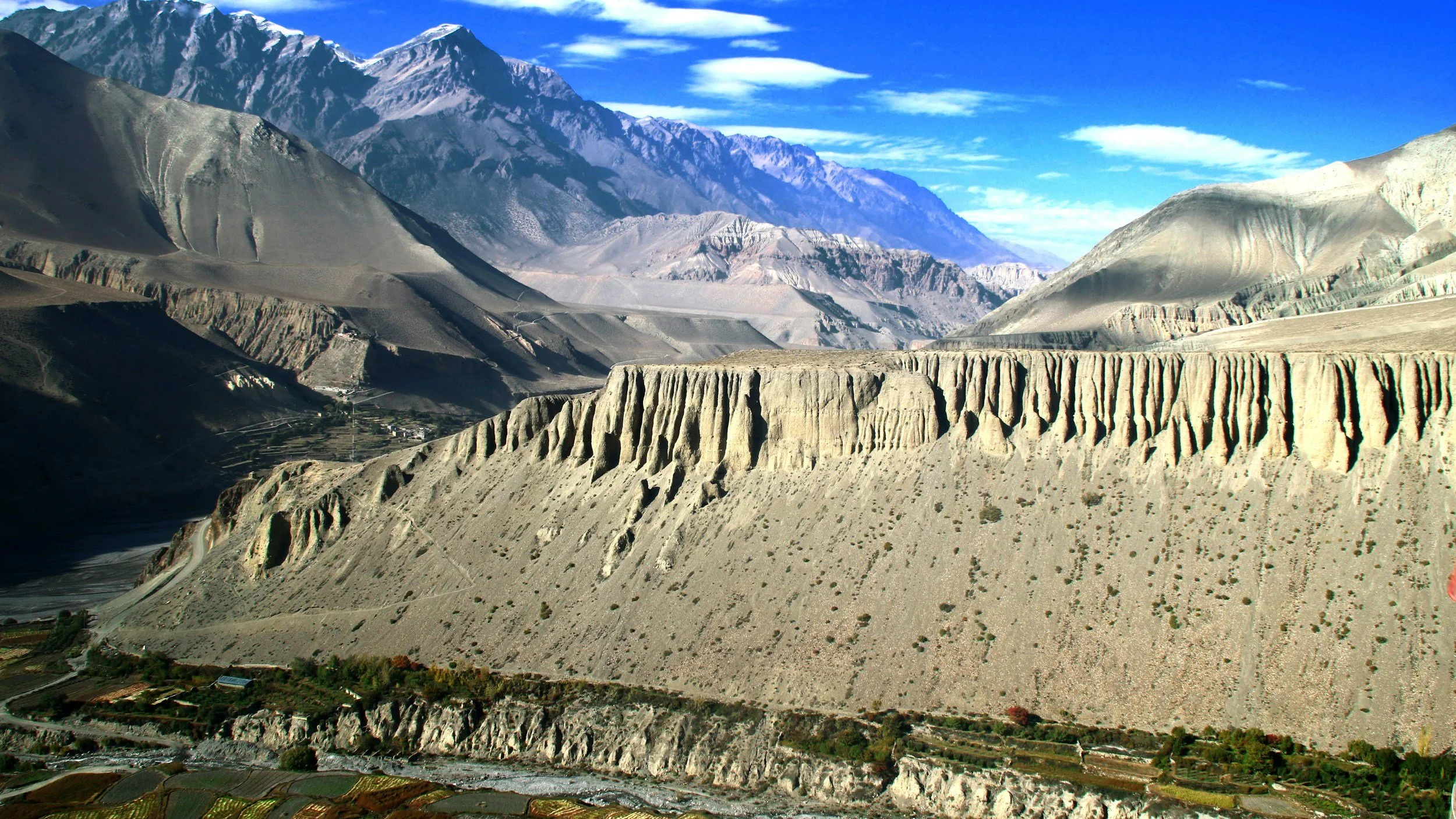
At four in the afternoon, we face a crucial choice: we can take the local sleeping spot or continue, in which case, in the least favorable scenario, we still have 3-4 hours ahead. It turns out badly; at seven in the evening, we arrive exhausted at the first lodge. A dog has been walking ahead of us all that time, seeming to want to show us the way. We are now at three km altitude, and the fresh, unmistakable scent of the beautiful coniferous forests softens the pain somewhat. We are served a good meal and sleep like a log. Only the next morning do we see what rocky outcrop is hidden behind the village—a dramatically steep mountain wall formed by glacial erosion, called the 'gate to heaven' by locals. We also learn that a trekker with a guide is half a day ahead of us—no better motivation for us. Slowly, the big peaks of the Annapurna come into view, and here and there, small, isolated remaining glaciers appear. Strangely enough, they are sometimes somewhat blackish due to embedded sand, pebbles, and gravel.
Days 4 and 5: Dhukurpokhari – Manang (3,000 m – 3,500 m)
Around noon at lunch, we coincidentally step into a restaurant with a French woman and her guide; apparently, we've overtaken them. She seems, just like us, glad and surprised to see a Westerner. Severe headache from the altitude is already bothering her, but it's nice to chat for a bit. We pass what can only be the least busy and abandoned airport in the world with an overgrown runway. Around four, we arrive in Manang, a well-known springboard and stopover on the way to higher places. The planned rest day is highly recommended for acclimatization and comes in handy to regain strength. Fortunately, here too, just like the previous stop, there's a hostess who speaks good English and even seems to have excellent cooking skills. Due to the season, there's little choice other than the local 'dal bhat,' a vegetarian curry with rice or chapati. We prefer to avoid alcohol in favor of the local 'seabuckthorn' juice, berries from a shrub packed with vitamins. The French woman overwhelms us with stories; she has lived here for years and has jewelry made that she sells in France. Meanwhile, her guide teaches our sherpa the finer points of the trade.
at some point, it will get wild up there
Nepal is an ethnically very diverse and complex country. Sandwiched between superpowers like India and China, the culture is defined by caste, hierarchy, and family. Over 80% of the population lives in mountainous areas, connected by an ingenious network of endless walking paths. Over the centuries, countless migration flows have taken place, and especially we encounter Tibetan, Indian, and lighter Pakistani-looking people. On less clear moments, we need a few seconds to realize exactly where we are, and flashbacks from old times in the Philippines, India, and China blur our sense of reality.
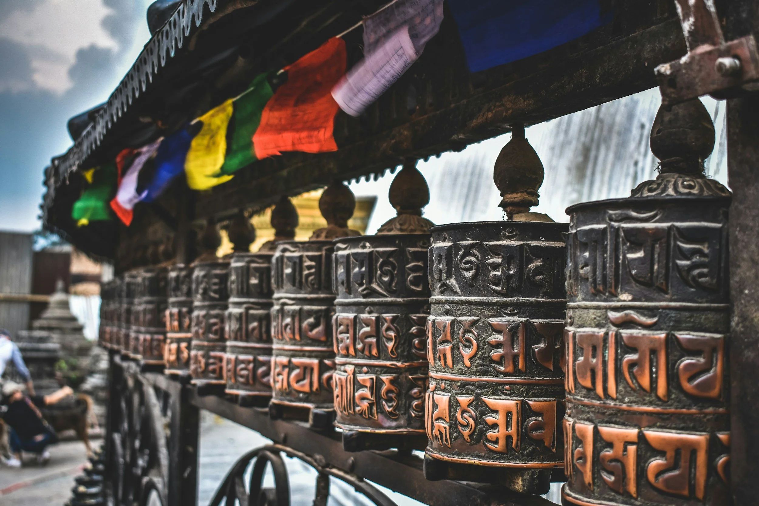
typical Nepali prayer wheels
At 3.5 km, the air is clearly thinner, and the first mild symptoms of altitude sickness appear. It's important to keep drinking a lot of water, although the body loses it just as easily during often sleepless nights. Our physical condition must get used to the altitude, and what works well is not ascending more than 750 meters per day and sleeping lower than the highest point reached that day—this can be achieved through separate acclimatization hikes of a few hours to 200-300 meters higher. Sleeping lower makes it easier for the body to produce more red blood cells that can transport oxygen better through the body. A method tried by many ambitious cyclists. It's very against our nature not to keep going, but the gradual approach is the only way to conquer high mountain passes. On the rest day, we become completely zen from two Buddhist monks who chant mantras all day in the restaurant, and we read the great book by Joris Luyendijk about the (still) rotten financial sector.
Day 6: Manang – Ledhar (3,500 m – 4,200 m)
We can get back to it; conditions are excellent. On narrow mountain paths, we are alone for hours amid the high, somewhat frightening white peaks. Frightening because occasionally the echo of breaking ice/snow resounds. In low season, the smaller 'tea shops' along the way are closed, and all water refill stations are shut. Not taking enough provisions is madness, and our sherpa's limited experience seems to affect him as he doesn't drink or eat anything for hours. He thankfully accepts a Snickers or Mars from us now and then. No wonder then that at the ghost town 'Yak Kharka,' he starts complaining about headache—same for us during lunch, but strangely, it's gone after a short break. The weather turns, and within 10 minutes, it's completely cloudy and wet; we can't see more than 30 meters ahead. At the hamlet with three houses 'Ledhar' at 4,200 meters, we hesitate long about what to do. We decide to continue for another two hours to the next town, despite earlier warnings about dangerous passages. It starts to storm more and thunder in the distance; we don't know if it's lightning or avalanches. Occasionally we stop, and we see less and less ahead—just then, a local appears from the mist who asks why we didn't stop earlier. We immediately turn around; there's nothing else to do but wait for better conditions in the very primitive hut.
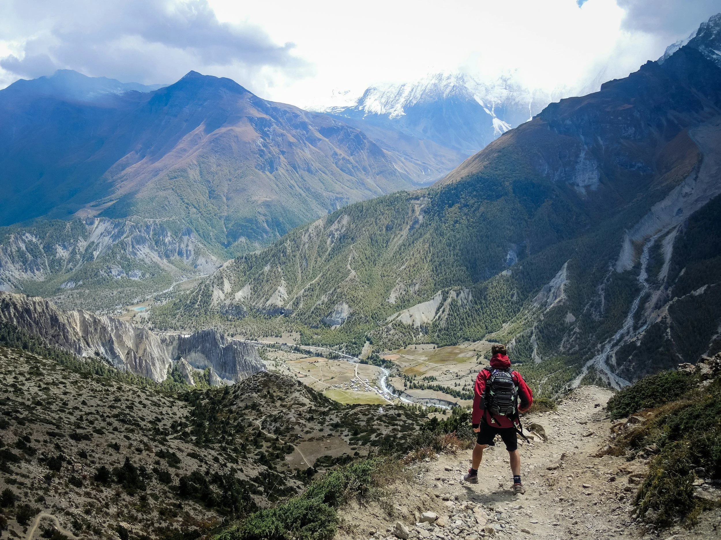
this is why we go all the way up - only possible by hiking
Day 7: Ledhar – High Camp (4,200 m – 4,900 m)
The first glance out the window predicts little good, but it's soon a radiant day with a clear blue sky. Lacking showers with hot water, the ice-cold stream from the mountains has served as a refresher for days. Even adventurous trekkers want to be catered to, and many a hectare of precious forest has already been burned for hot showers. Not very sustainable, and alternative energy sources like hydropower plants are being built, though the electricity gladly flows away to India and China. Whoever pays, decides. Well past the tree line, we trek through the canyon toward Thorong Phedi, also known as 'base camp' at 4,500 meters, avoiding a herd of yaks. The yaks are great climbers and provide milk, cheese, and meat for the local mountain people. A large male yak is not to be confused with the Yeti, the still unsolved mystery about the existence of the human/animal 'bigfoot.'
Little time to daydream about this; obstacles loom ahead—whole sections of mountain wall have been swept away, and the other side is hardly better with a narrow gravel path. In fact, they are steep slopes full of stone and gravel with what should resemble a path over them. Life-threatening. A loose stone or misstep, and you're 50 meters below. As if that's not enough, a galloping herd of yaks appears out of nowhere, right on this section! Panic on our sherpa's face, for the first time. We can't go anywhere; an unpredictable move from this beast means serious problems. In fact, we can only wait and see what happens, and we even manage to snap a photo in time. We soon see that there's a shepherd behind the herd, who thankfully manages to get the animals higher up the mountain wall with pebbles and sounds. We stayed reasonably calm but realized we had lost control. Exhausted, mainly from tension, we reach the penultimate camp before the top and need an hour to recover. Physically, we feel good, and as we step outside, we look for the path—every scenario involves a steep, rocky climb, and it's hard to imagine we'll end up on that protruding rock above.
chill Lakeside town of Pokhara
Wiser from damage and shame, we consciously go very slowly at a pace of 2 km/h up the mountain, interrupted by some water breaks. The higher, the more essential water intake becomes. For example, at 6 kilometers altitude, there's only 50% oxygen in the air compared to sea level (on Mt. Everest 29%), making it harder for humans to absorb oxygen. The body's response is to increase heart rate and accelerate breathing. Because the air is so dry, you lose more moisture through accelerated breathing. This must be compensated. What plays a role is that the blood becomes thicker; drinking a lot counters this somewhat. The little oxygen present is used for the most important body functions: heart, lungs, and brain functions. The capacity for other processes is considerably reduced, so for example, the thinking process slows down. Oxygen molecules become scarce, and different body functions compete assertively for their favors. Several times, we experience not being able to reproduce simple facts. The advantage is that daily worries fade into the background, and we can only focus on staying fit and reaching the top. No wonder some retreats are held at altitude! Digestion also costs oxygen, and sometimes even the thought of eating evokes some aversion. Body reserves are (to a certain extent) no luxury at greater heights.
We know that if we reach high camp at 4,900, we've taken an essential step toward our ambition for this trek. It's deserted up there, and we're glad when someone finally opens the door. With about 100 beds available, we don't have to worry about a sleeping spot. A pounding headache sets in, accompanied by mild nausea. Our hands have been swollen for days. Not a good sign, and although we have no appetite at all, we force down a dal bhat. People with severe altitude sickness are experienced as drunk and can no longer walk a straight line. The three of us stare blankly ahead for a long time and see how the weather completely turns in no time. Hail, rain, and strong gusts of wind completely isolate us in this lonely and high mountain hut. It's hard to imagine that in better times, dozens of people gather here and have fun.
Our host has a lonely job and runs this place independently, from gardening to cooking and cleaning. During the earthquake three months ago, he was at the same window where we are now sitting, witnessing how the earth around him trembled and shook. We feel a bit better and venture to a peak 150 meters higher; it goes reasonably until at incredible views above, we become nauseous again. These are moments when we, actually belonging at sea level, wonder what on earth we're doing here and quickly descend. Two remarkable figures ascend; they are Buddhist monks on a pilgrimage or outing. They too will attempt it tomorrow, and in the evening, we enjoy a healthy last supper in camaraderie, although speaking English is hardly possible.
from the holy city of Muktinath it gets barren and dry
Day 8: High Camp – Thorong La – Muktinath - Jomsom (4,900 m – 5,416 m - 2,800 m)
In hindsight, we read that it would have been better to sleep a bit lower before crossing the mountain pass. Nevertheless, at five in the morning—after a stone-cold night—we're up to beat strong and cold wind gusts on the top in the course of the morning. The quartet, of diverse backgrounds, begins the approximately three-hour climb. After the cloud and mist banks, above 5 km, we feel like we're on the roof of the world. Around us, only breathtaking views with snow-capped peaks of Annapurna I, II, and III. It's unbelievable that a group of local young men is building a stone hut here. In the time of the Maoist rebels, not so long ago, there was a good chance we'd be asked for 'toll' or 'donations' before continuing our journey.
Like a diesel, we pull steadily upward, stoically, at our own pace. It's clear that the others can go faster; we expected that from our two monk friends, our sherpa perhaps exceeds his own expectations, and what he shows is an impressive feat. We stay together, and of the four kilos of water we're carrying, half is gone after 1.5 hours. We walk on a moon-like landscape amid two peaks, clearly the shape of a mountain pass. Fortunately, it's not so steep here, and after some time, it becomes clear we're near our goal. Without really getting into trouble on the last climb, unlike last year, we reach Thorong La at 5,416 meters above sea level. Aside from the usual photo rituals, we don't want to linger too long at this altitude; headache is knocking or has already entered for some.
The descent is technical and long, maneuvering through stones, gravel, and debris while sparing ankles and knees. That it went completely wrong here at the end of last year when an unexpected snowstorm hit is tragic; stories from survivors are almost unbelievable. Descending with a meter of snow over this sometimes very steep descent is madness. The whole lower body starts hurting badly meanwhile; the view of the endpoint a kilometer lower and far on the horizon is both discouraging and enchanting. As if looking through a window into another world. A world of dry desert rocks, bordering Tibet in culture and location.
After a short, uninspired bite to eat, it's trudging, limping, and stumbling to the ancient temple of Muktinath where our two friends want to create a photo moment. It's only 1:00 PM when we arrive in the adjacent sleepy town. No place to stick around. Usually, the bus is taken here to the further Jomsom; the alternative is a four-hour trek over barren, windy, and dusty roads. Not a pleasant prospect, and only with painkillers could we continue. We crave a shower, healthy meal, and bed. The others are also exhausted, and we pool money for a jeep that, completely shaken up, drops us in Jomsom. Thereby, as it turns out later, leaving a beautiful, centuries-old trading town on the left.
Day 9: Jomsom – Pokhara (2,800 m – 800 m)
Where the two monks get the energy from is a mystery to us, but they kept traveling and walking. Perhaps they worry much less than Westerners. Packed like sardines, even though there's no sea in sight, they began a day-long ride to Pokhara. We had set our sights on a hotel we'd seen advertised earlier, and it didn't disappoint us at all. To complete the full circuit on foot, it would have been another three days walking to Pokhara, the least interesting part aside perhaps from Poon Hill. The very windy Jomsom even has a primitive airport; however, tickets to Pokhara for the next day were sold out. An entertaining Indian, the hotel manager, updated us on the area and promised to check if a spot would become available the day after. It did; the good man was knocking on our door at 6 AM. We had to go straight away, head over heels on foot to the airport two minutes away. Where else do you find your backpack weighed on an old-fashioned pointer scale? A group of Flemings quickly filled the 'plane,' not entirely surprising since it's a propeller-type Dornier 228 where you can still cozily watch along with the pilots.
Three days in Pokhara make us restless enough to want to head out again. Into the mountains, where it's quiet and clean. The surrounding area offers a wide arsenal of interesting 'trekking trails' that are manageable individually. And so it happens that, after being dropped off by a taxi, we immediately ascend endless stair steps, in the form of flat, worked granite slabs. Soon it turns out that, contrary to what we suspected, the southern trails of the Annapurna Conservation Area are more frequently walked by tourists than the northern part from last week. Yet, the bulk of the daily monsoon rain falls here; the reason might be sought in the lower difficulty level and proximity to Pokhara. Anyway, the sweltering rainforest harbors cunning and dubious residents, from clandestine weed-selling 'didis' to the dreaded 'leeches.' Especially these bloodsuckers are a real plague for naive passersby in the rainy season. Almost unnoticed and lightning-fast, the critters crawl from your shoe up your leg, searching for the nicest spot to gorge on human blood. Though relatively harmless, it's mainly the uncomfortable idea that makes you preventively check your shoes and legs regularly. It's bizarre how quickly this creature, sometimes used for medicinal purposes, sticks to your sole and finds its way up. There must be billions in this forest because standing still for five seconds guarantees 1 or 2 new body inhabitants.
Keep walking is the motto. And we do, in good condition, passing lodges, teahouses, and sweeping past other trekkers. The terrain goes constantly up and down. When you've reached the fresh, cool flowing river, you know it's time to climb again. In the late afternoon, we arrive in Landruk; however, the goal for the day was Ghandruk on the other side of the valley. This to have a good chance of completing the trek in exactly three days. The standard questions from locals become predictable: 'from which country' and 'where are you coming from now'; in turn, it's always 'how long to...?' Various sources confirm two hours, most of which is the steep stairs up to Ghandruk. It starts pouring heavily, and equipped with a rain poncho, we pass a sheltering trekker shortly after. It's an overly heavily packed, unprepared young Australian (with Dutch roots) who can barely move forward and asks us if there are lodges up top. We confirm this, and taking her second bag, we hurry, eagerly looking forward to a dry, warm sleeping spot. This goal comes within reach around six. Our travel companion, only twenty years old, turns out to have gotten lost too, but this can still be fixed the next day. A cold shower, dry clothes, and 'dal bhat' do two tired travelers good at the end of the day.
The mornings in the mountains are wonderful: fresh and beautiful views. Lemon-ginger-honey tea and the exciting 'Into Thin Air' book make for a complete morning ritual. Soon our paths separate; we would have joined the longer trek if not for time constraints. Slippery paths upward follow; the first trekkers doing the route in reverse appear, and experiences are briefly exchanged. Maniacally obsessed with the leeches, we press on and encounter an unmistakably Dutch couple in a mountain hut. Pick two people from the crowd at Utrecht Central and place them abroad; recognition is easier than many an 'Oslo confrontation.' Encountering Dutch people abroad is, exceptions aside, not exactly one of the highlights of an average vacation. This is such an exception, and with more interest and enthusiasm than usual at home, we exchange experiences.
We walk briskly for many hours; during a downpour, we take a big slip in the mud. Just before the finish line of the day, a defensive buffalo blocks the path; the leeches have free rein while we make a cautious detour. Ghorepani is a truly desolate affair; you can only choose the least uninspired hotel. Not entirely sure if this succeeded, we end up at the dinner table with an old, weird Japanese man whose sole life goal has been limited to climbing Mt. Everest. Another strange character completes the trio; the food is lousy. The town is the springboard to the famous viewpoint 'Poon Hill' at 3,200 meters. Early in the morning with clear weather and rising sun is the tried-and-true ideal scenario; however, we first enjoy the pancakes before setting off upward. The views are indeed phenomenal, with almost every snow-capped peak of the Annapurna clearly on the retina. The absence of other tourists makes for a beautiful experience.
A long descent follows, interrupted by short breaks in the villages. The ongoing route is used by many pack donkeys besides walkers, resulting in stinking piles of dung. It takes little imagination that with rain showers and groundwater, these remains end up in local streams that serve everywhere as the main drinking water source. We are equipped with water purification drops, but the taste doesn't improve. Cows are not hindered in any way and are unmistakably part of the daily street scene. Dogs, on the other hand, are kicked quite quickly and pelted with stones.
Literally while writing this paragraph, the Russian couple with whom we trekked parts of the last section walks by here in Pokhara. We ask how we ultimately got back to the city since the most treacherous part, without realizing it, was still ahead. The guy had already heard somewhere that on the main route back to Pokhara by bus, there had been major mudslides, resulting in blockades and thus jams. Last night, it rained almost incessantly. The streams and rivers increase in strength and deposit more loose stones and gravel. The sometimes not very sturdy slopes with rice fields collapse under the pressure, and entire mudslides flood the roads. When we arrived at the endpoint in the late afternoon, we had little idea of the chaos unfolding further on. Soon we had to get out of the car and saw how the mobile unit tried to take control of the situation. This was no easy task, as in some sections, two hundred meters wide, the road was completely flooded with mud and stones. Sections of mountain slopes have been completely wiped away, and ongoing travelers try to continue their way through rice terraces. Buses and freight transport are stranded, and we just keep walking, looking for something to take us to Pokhara. Unlike the Russian couple, we ultimately succeed, and back in the city that evening, the extent of the local disaster that has unfolded becomes clear - nearly 40 people had to lose their lives in a region already so plagued with calamity.